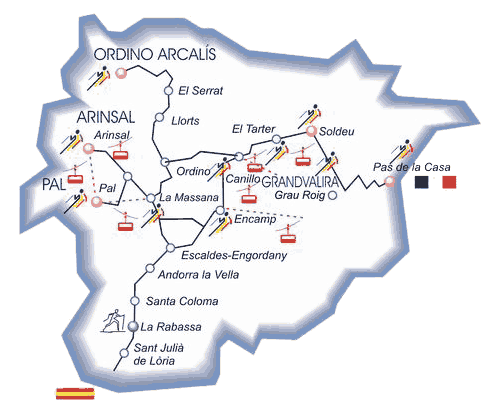
The Principality of Andorra is an independent
and democratic European state, in the heart of the Pyrenees.
With an area of 468 km², Andorra has a population of
over 78.000 inhabitants.
Andorra consists of three valleys in the shape of a Y, cut
through by the rivers Valira del Nord and Valira d’Orient,
which join to form the Gran Valira.
Coma Pedrosa is the highest peak (2.946m);
the lowest point is located at the confluence of Runer
and Gran Valira rivers (840m). The average altitude of the Principality is 1.996m.
Andorra shares its north and east borders with the region
of Foix in France, (56,6km), its south and west borders with
Spain (63,7km).
Its geographical location (one of the highest areas in Central Pyrenees) entails a continental climate,
subject to influences from the Atlantic (precipitation) and
the Mediterannean (purety of atmosphere). Therefore our climate is mainly Continental, with cold winter temperatures and hot summer ones.
Average temperatures:
36°F to 59°F (2°C to 15°C) in winter,
around 59°F (around 15°C) in spring or autumn and
77°F to 95°F (25°C to 35°C) in summer.
The 1st july 2004 the Madriu-Perafita-Claror
Valley was listed as UNESCO World Heritage Site.
